
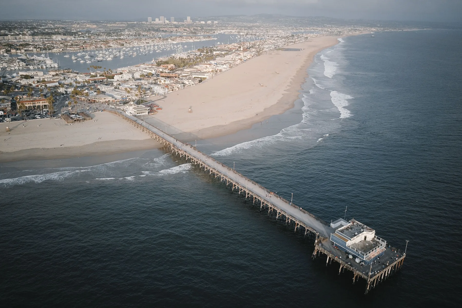
If you live along the harbor or the peninsula, or you're thinking about buying a home in Newport Beach, this winter is asking more of us than a typical high-tide season. King tides are arriving alongside a strong El Niño, and the City of Newport Beach has already warned that low-lying waterfront areas may see coastal flooding. Here's what that means for homeowners, buyers, and sellers—and how to check a property's flood risk.
What are king tides?
“King tide” is a popular, non-scientific term for exceptionally high tides. According to NOAA, these higher-than-normal tides typically occur during a new or full moon, when the Moon is closest to Earth (its perigee), or during certain seasons. On the West Coast, they are most common around the winter and summer solstices. The calendar is predictable. What varies is how high the water actually gets once weather, waves, and ocean conditions are added on top of the tide chart.
A strong El Niño is raising the starting line
El Niño is a climate pattern marked by warmer-than-average ocean temperatures in the tropical Pacific. NOAA’s Climate Prediction Center, in its November 12, 2026, ENSO discussion, said El Niño continues to strengthen, with a strong-to-very strong El Niño likely through January–March 2027 (greater than a 79% chance).
That matters here because warmer water expands, and El Niño can also send pulses of warm water, called Kelvin waves, toward the West Coast. NOAA explains that those waves can temporarily raise sea level by 6 to 12 inches or more for several weeks. Tides then ride on that higher water. When a king tide lines up with elevated sea levels—and especially with storm surge, rain, or large surf—flooding can reach farther inland than on a typical high tide. From October 24 to 30, 2026, NOAA tide gauges recorded all-time high water levels in San Diego, La Jolla, Los Angeles, and Santa Barbara.
NOAA also notes that more Kelvin waves are likely this fall and winter. The Climate Prediction Center’s November 19 seasonal outlook favors above-normal precipitation for California from December through February, with probabilities exceeding 60% in Southern California. Those are odds, not a guarantee.
How this is showing up in Newport Beach
The City of Newport Beach has been issuing king tide advisories and asking residents in low-lying waterfront areas to prepare. In October 2026, the City Council declared a local emergency ahead of exceptionally high tides expected October 26–28. The City activated its Emergency Operations Center, reinforced protective beach berms, prepared tide valves and pumps, and positioned sandbags in flood-prone areas.
Officials said recent ocean water levels had been about 18 to 22 inches above predicted astronomical tides. The City later reported that October’s high tide reached a record 8.4 feet and warned that tides expected November 23–27 could run 12 inches or more above that mark—high enough to affect properties that stayed dry in October. Additional high tides are expected December 22–26 and into the new year.
On its El Niño and Coastal Flood Preparedness page, the City highlights particular risk in low-lying areas, including Balboa Island, Newport Island, the Balboa Peninsula, West Newport, Newport Harbor, and the Finley Tract. Elevated water can overtop seawalls, flood streets, and close roads. Many harbor seawalls are privately owned, so property owners play a direct role in how well a block is protected.
Flood zones, flood insurance, and the limits of the map
If you are buying a home in Newport Beach with a federally backed mortgage, flood insurance is not optional in a high-risk flood zone. Lenders use FEMA flood maps to determine whether a property sits in a Special Flood Hazard Area, and federal rules require flood insurance for buildings in those areas when the loan is federally backed or comes from a federally regulated lender.
Special Flood Hazard Areas are the zones FEMA maps as having at least a 1% chance of flooding in any given year. They include designations that start with A or V, such as Zone A, AE, AO, and VE—zones used in coastal communities including Newport Beach. FloodSmart, the National Flood Insurance Program’s site, states that if your property is in a high-risk zone and you have a government-backed mortgage, you must buy flood insurance.
The map is an important starting point, but it is not the whole story. Newport Beach’s official FEMA maps became effective on March 21, 2019. They are built around a specific flood scenario and do not automatically capture every king-tide event, short-term El Niño rise in sea level, or winter storm. A home outside a mapped high-risk zone can still take on water. FloodSmart reports that from 2014 to 2024, nearly one-third of National Flood Insurance Program claims came from outside high-risk flood areas. Standard homeowners insurance typically does not cover flood damage, so even owners outside a Special Flood Hazard Area may want a quote.
What homeowners, buyers, and sellers can do now
Look up the flood zone. Search the address on the FEMA Flood Map Service Center and on the City’s tools linked below, and note whether the home is in a Special Flood Hazard Area.
Ask about flood history, not just the zone. In California, sellers of most residential properties must complete a Natural Hazard Disclosure Statement that includes whether the property is in a FEMA Special Flood Hazard Area. Still ask whether the street, garage, or seawall has taken water during high tides or storms, and whether the seller carries flood insurance.
Get a flood insurance quote early. NFIP policies generally take effect 30 days after purchase, with limited exceptions such as buying coverage when you close a mortgage. Do not wait until the next advisory.
Prepare the property. Place sandbags or temporary barriers at low seawalls, garages, and doorways; check private drains and tide valves; inspect seawalls for low spots or damage; and move vehicles, including EVs and golf carts, to higher ground. As of the City’s November update, free prefilled sandbags are available at the Corporation Yard, 592 Superior Avenue, while supplies last, and empty bags are available at fire stations and Lifeguard Headquarters, 70 Newport Pier. Call Municipal Operations at 949-644-3055 to confirm availability, or check the City’s preparedness page. Do not drive or walk through flooded streets; vehicle and boat wakes can push water onto nearby properties.
Watch the next tide windows. The City and NOAA both flag late November and late December as periods of above-normal high tides. The California King Tides Project lists statewide dates of November 24–26, December 23–25, and January 21–22, 2027.
Flood map and tide resources
Use these planning tools to check a Newport Beach address. They are not a substitute for a site visit, a survey, or advice from your lender and insurance agent.
- FEMA Flood Map Service Center — official Flood Insurance Rate Maps, searchable by address
- City of Newport Beach flood zone address search
- City of Newport Beach interactive flood map
- City FEMA floodplain management page
- NOAA Sea Level Rise Viewer — sea level rise and high-tide flooding (planning reference only)
- Our Coast, Our Future Hazard Map — USGS CoSMoS storm, erosion, and groundwater hazards
- NOAA Monthly High Tide Flooding Outlook
- NOAA Coastal Inundation Dashboard — real-time water levels at NOAA tide gauges
- California King Tides Project
- City of Newport Beach El Niño and Coastal Flood Preparedness
A clear-eyed way to love this coastline
Newport Beach is one of the most beautiful places in Orange County to live, and that waterfront lifestyle is exactly why these tides matter. King tides and El Niño do not mean every home near the harbor will flood, or that you should avoid the market. They do mean going into a decision with good information: the official flood zone, the property’s history, a current insurance quote, and a plan for the next high-water cycle.
If you are buying or selling a home in Newport Beach, or you want help thinking through how flood zones and insurance may affect a specific property, I would be glad to talk it through with you.
Kayla Breneman, REALTOR®, Bon Life Real Estate, Orange County, CA
Sources
- NOAA, What is a King Tide?
- NOAA Climate Prediction Center, ENSO Diagnostic Discussion, November 12, 2026
- NOAA Climate Prediction Center, Long-Lead Seasonal Outlooks, November 19, 2026
- NOAA, California water levels break records, November 4, 2026
- City of Newport Beach, City of Newport Beach Declares Local Emergency Ahead of Upcoming King Tides, Activates Emergency Operations Center
- City of Newport Beach, City of Newport Beach Provides Preparation Update Ahead of November King Tides
- City of Newport Beach, El Niño and Coastal Flood Preparedness
- City of Newport Beach, FEMA Flood Management
- FEMA, Understanding Flood Risk: Real Estate, Lending or Insurance Professionals
- FEMA, Special Flood Hazard Area (SFHA)
- FEMA, Flood Zones
- National Flood Insurance Program / FloodSmart, What’s Your Flood Risk?
- National Flood Insurance Program / FloodSmart, Buy a Flood Insurance Policy
- FEMA Flood Map Service Center, Welcome
- NOAA, Sea Level Rise Viewer
- Our Coast, Our Future / USGS CoSMoS, Hazard Map
- NOAA Tides & Currents, Monthly High Tide Flooding Outlook
- NOAA Tides & Currents, Coastal Inundation Dashboard
- California Coastal Commission, California King Tides Project
- California Civil Code § 1103 et seq. (Natural Hazard Disclosure Statement)